Following the strong stratospheric warming in mid-March, the Polar Vortex aloft has collapsed. Its remnants are now moving across Canada towards the eastern United States. Its strong lobe will produce a significant cold event across the Great Lakes and the Northeast early this week.
While a progressive and dynamic weather pattern continues across North America into April, the collapse of the Polar Vortex a few weeks ago will result in a significant Arctic blast from central Canada into the Northeast United States.
The ongoing weather pattern has resulted in multi-day periods of severe weather further south across the nation, where tornado season is ramping up. Flooding issues have developed with the large storm clusters from mid-Mississippi into the Tennessee Valley. The amounts of rain will be very high, with historic flooding in some areas.
While severe weather will continue down south into the early days of next week, the weather is forecast to significantly change further north from the Upper Midwest across the Great Lakes into the Northeast U.S. A much colder weather arrives on Monday.
Here is a quick overview of the developing pattern this weekend into early to mid-next week. While strong blocking high and warmer weather is established in the west, a significant Arctic cold blast is over the Northeast.
After the substantial disruption of the polar vortex and the shift of patterns across North America, one of the cold pools is heading across central Canada towards the U.S. It will change the jet stream aloft and dip it towards the eastern part of the continent, bringing much colder-than-average temperatures to the Northeast region.
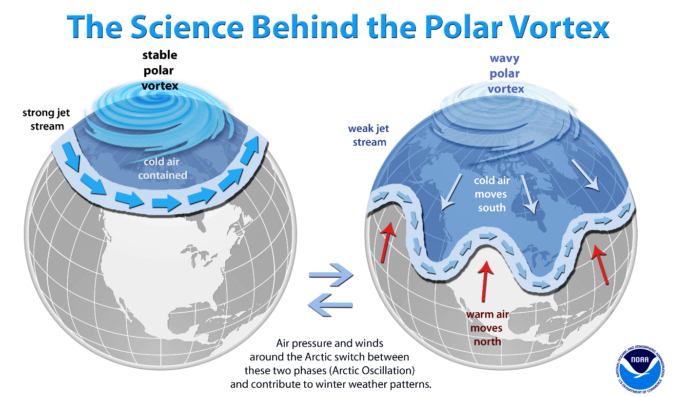
Before we discuss the details of the upcoming event, we want to consider the main trigger behind these cold events. The intense Arctic blasts often follow a substantial disruption of the Polar Vortex aloft. This disruption may be temporary during the winter season, or the events may follow when the polar vortex finally collapses in early spring.
What is the Polar Vortex?
The Earth’s atmosphere has six layers around the planet. Most of the dynamics for our daily weather occur in the lowest two layers, known as the troposphere and the stratosphere.
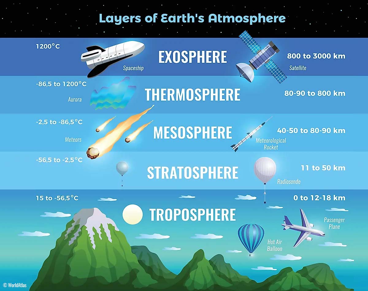
The troposphere is the closest layer to the Earth’s surface. It is about 12 km deep and extends from the ground up high into the sky. Depending on where you live, its depth varies from around 8 km to almost 20 km. The troposphere is the deepest above the equatorial region and gets much thinner above the North and South poles.
Above this layer is a much deeper one known as the Stratosphere, an 11-50 km thick layer of arid air. The stratosphere also contains the ozone layer, which protects our planet’s life against the potential impact of solar storms from the Sun or outer space.
Another essential feature in the stratosphere, which makes our weather even more variable, often triggers significantly large-scale and long-lasting winter weather events. This is the Polar Vortex—an enormous, tri-dimensional ring of powerful winds moving through the sky above us. The Polar Vortex is spinning around the North Pole, grazing through the air at about 20-50 km above the Earth’s surface with violent wind speeds.
The troposphere and stratosphere are crucial for our climate. The Polar Vortex covers most of the bottom half of the atmosphere. Since the vortex extends from the middle of Earth’s troposphere into the stratosphere layer, it significantly affects winter weather across high and mid-latitudes yearly.
We have experienced this in Asia, Canada, the U.S., and sometimes Europe in recent years. The vortex aloft has been significantly disrupted, and when its lobe shifts on the other side of the northern hemisphere, the extreme cold grips the North American continent.
Towards the end of winter, sudden stratospheric warming often occurs, resulting in a significant disruption of the Polar Vortex. Its large-scale weather pattern shifts further south across the northern hemisphere, posing the risk of early spring cold outbreaks and damaging frosts to blossoming trees and crops.
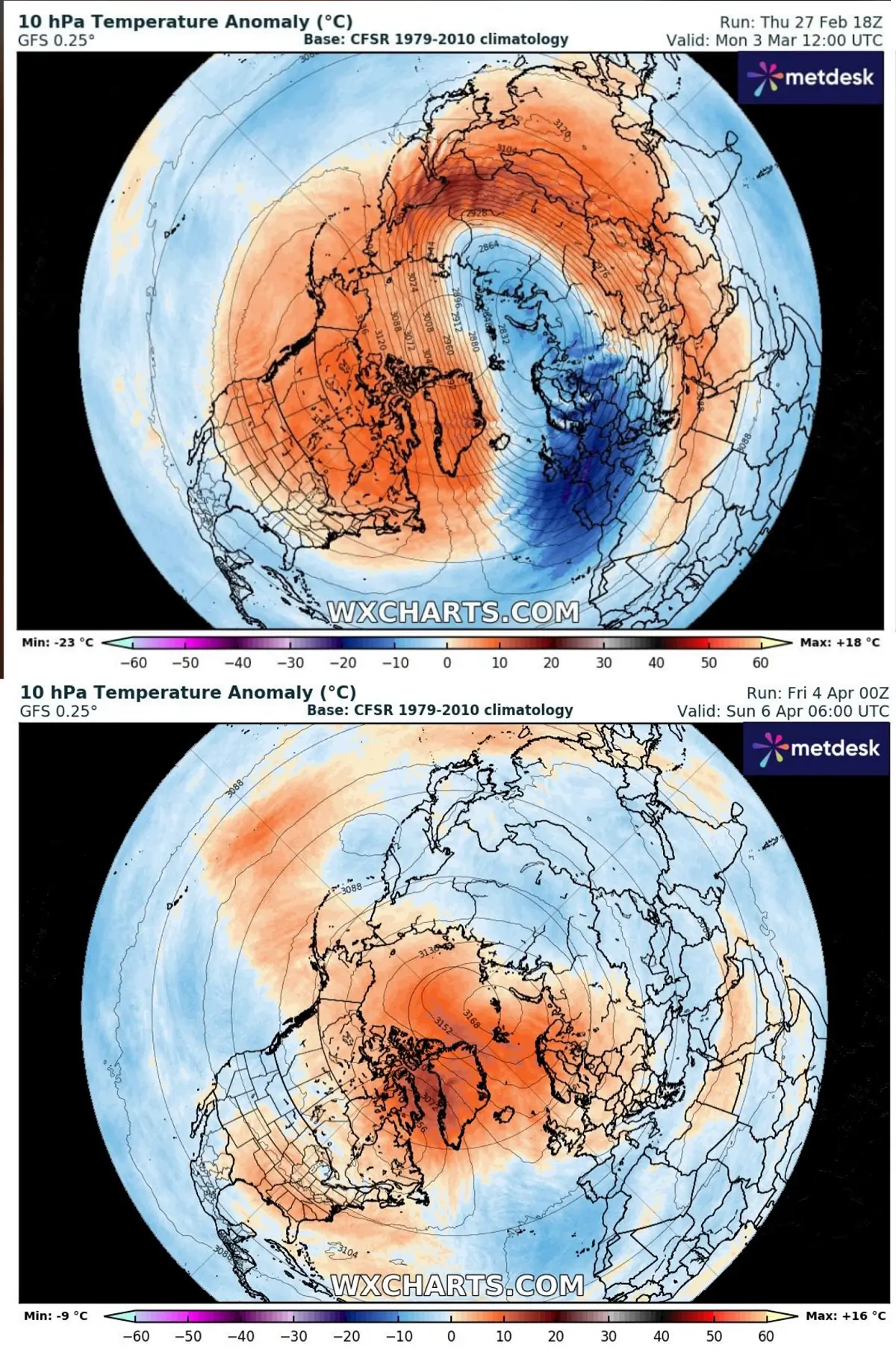
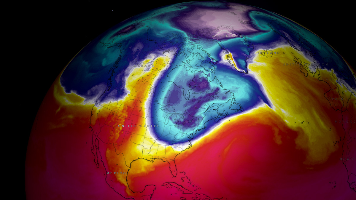
The comparison chart above shows the state of the polar vortex in early March compared to next week. We can see a disrupted circulation, with warmer air over the North Pole while the cold has shifted away far towards the South.
Polar Vortex remnants send an intense Arctic cold blast from Canada into the Northeast U.S.
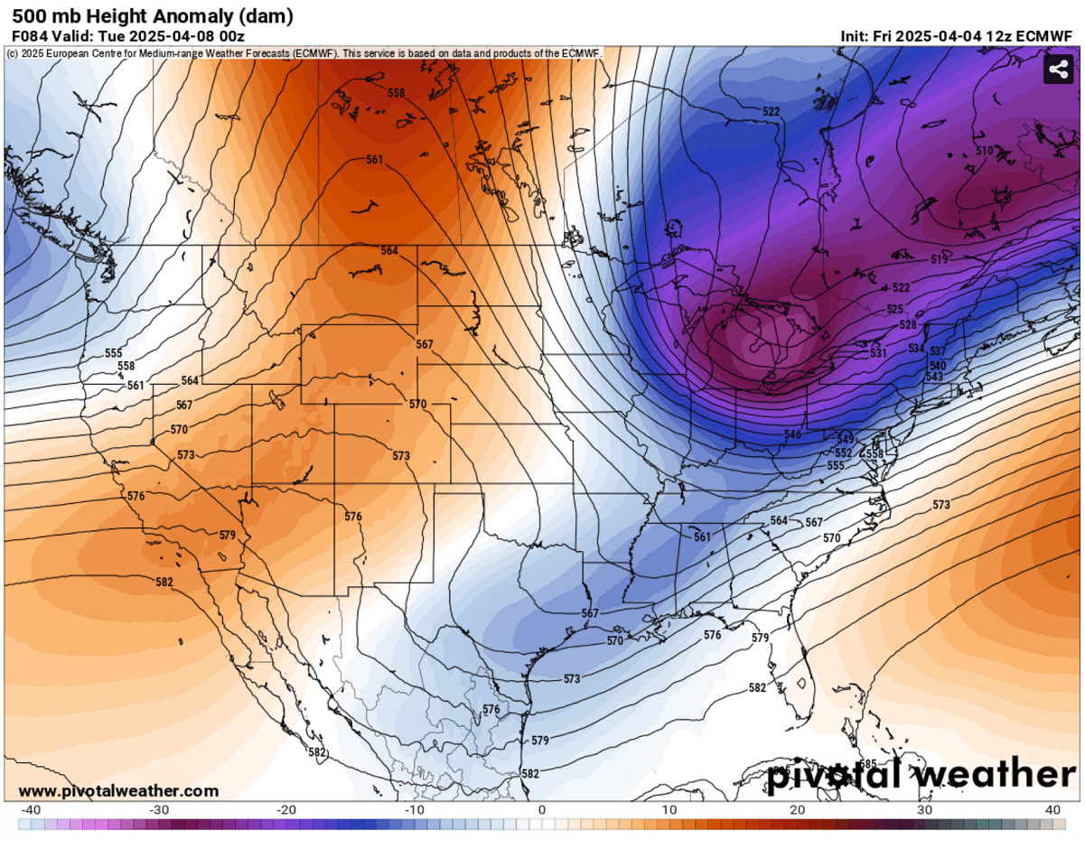
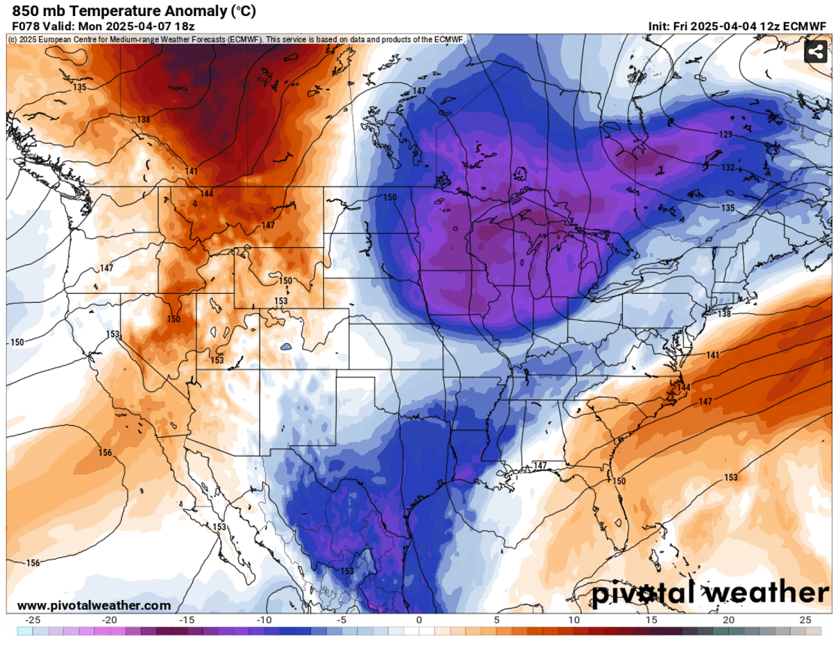
With the remnants of the collapsed Polar Vortex floating away from the polar regions, one of the cores was pushed into east-central Canada this weekend while deepening on its way towards the Northeast U.S.
A deep cold core will emerge across the Great Lakes into the Northeast Monday through early Tuesday, dragging a significantly colder air mass in the upper levels.
The related surface response builds up a firm, high-pressure system over central Canada and the United States, with a surface low over the Northeast and Nova Scotia. This results in the deformation of the polar jet stream into a more north-northwesterly direction.
This will transport the cold air mass over the region, thanks to increased northerlies resulting from the tight pressure and temperature gradient between the two large-scale systems.
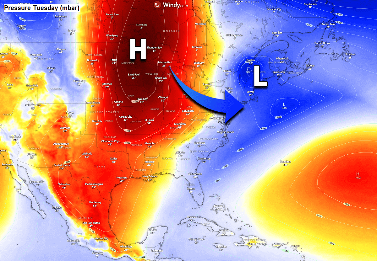
The surface low will be relatively small but intense as it moves beneath the cold core across southern Ontario and the northern Great Lakes region towards the Northeast U.S. Monday night into early Tuesday.
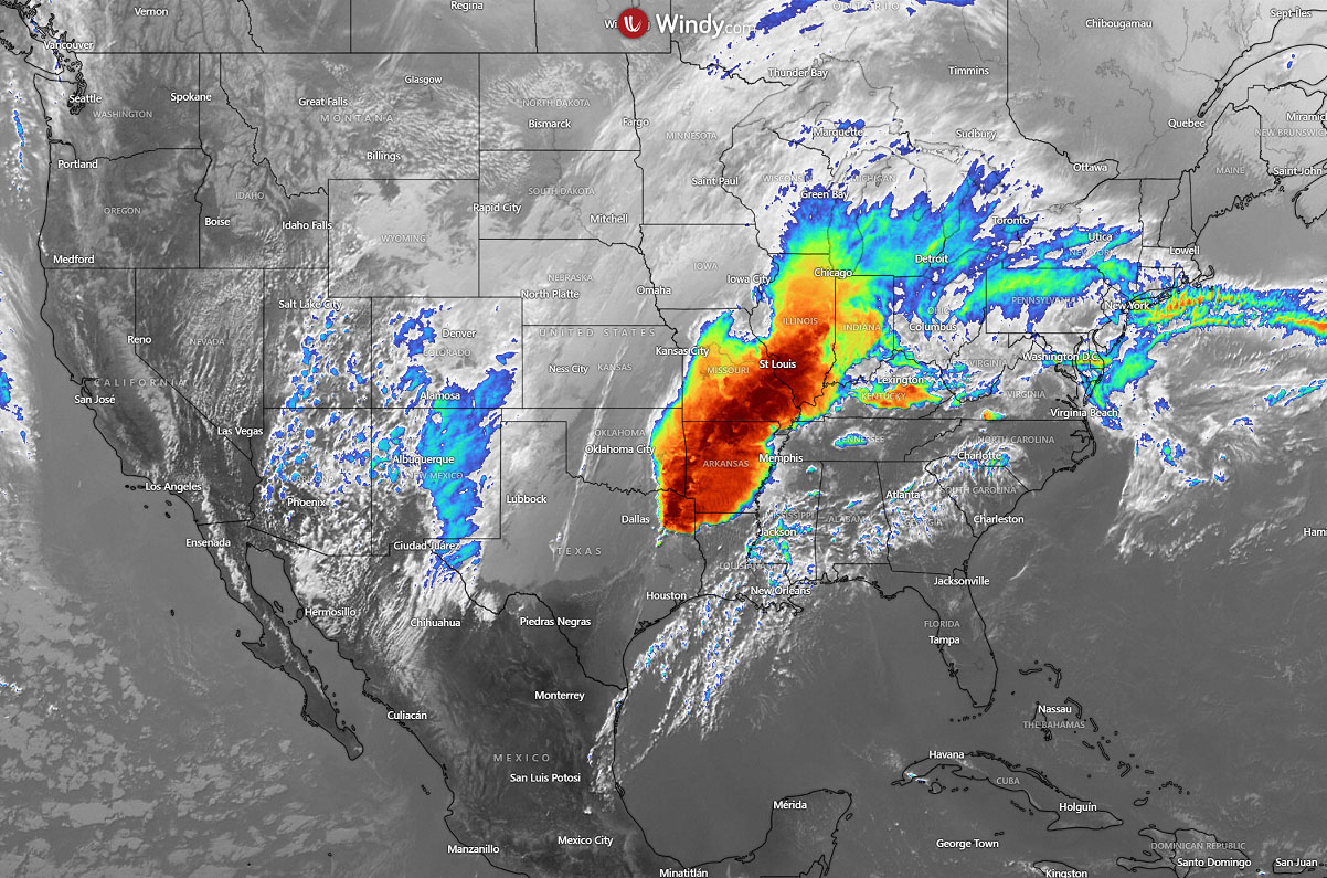
Heavy snow is forecast on the northern side of the low, with near-blizzard conditions as snowfall combines with strong winds. Whiteout conditions could occur with low visibility and disrupted travel conditions.
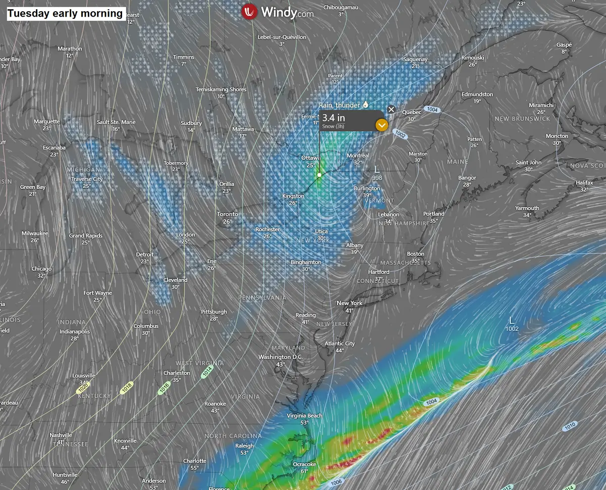
The highest amounts of snow are forecast across the northern tier of the Great Lakes, mainly across southern Ontario. Ottawa and Montreal could receive a good amount of snow.
Strong winds will also build snow drifts, although the amounts of snow are not expected to be particularly significant. However, up to about a foot of snow will locally be possible.
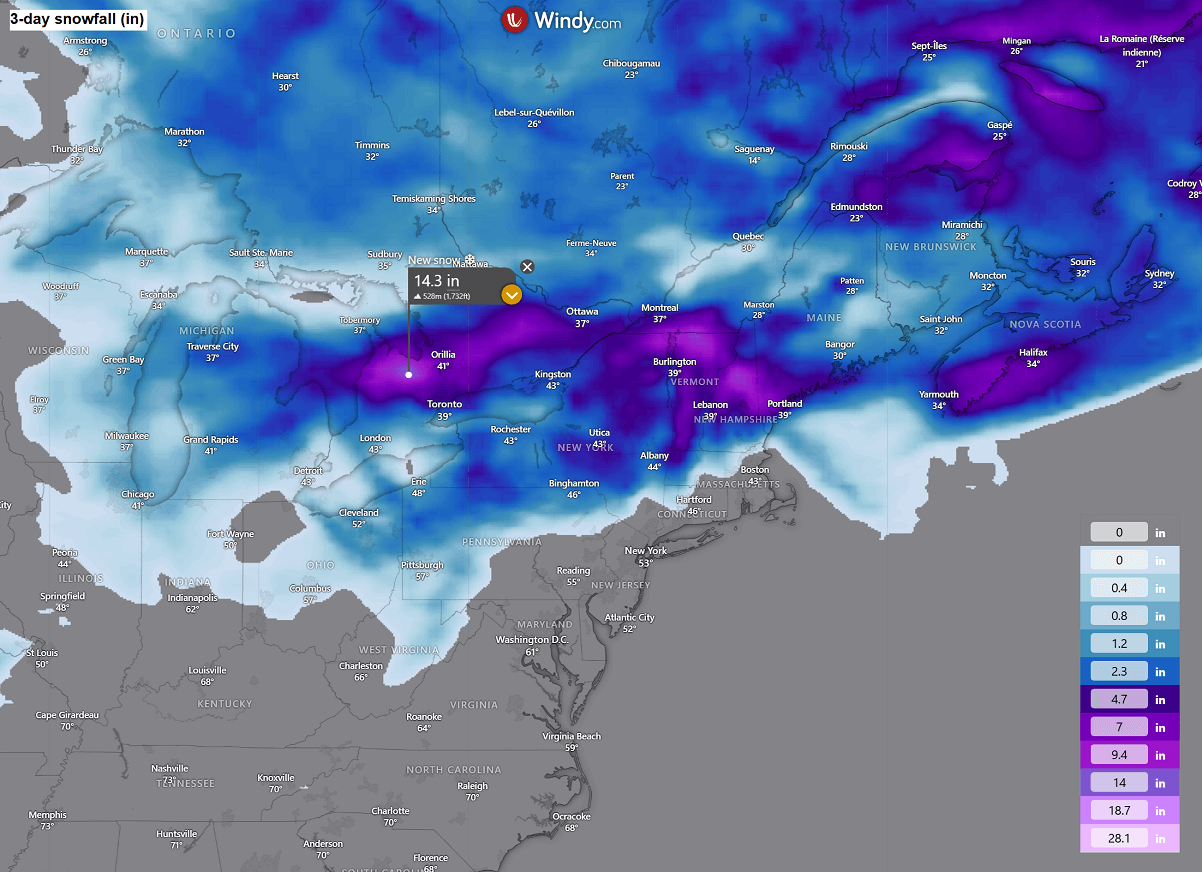
Some lake-effect snowfall is also forecast, thanks to persistent cold winds across the lakes Erie and Ontario.
A much colder air mass spreads in the wake of the cold low across the Upper Midwest, Great Lakes, and the Northeast U.S.
The significantly colder air mass will first spread into the Upper Midwest and western Great Lakes by midday Monday, gradually advancing east-southeast Monday night into Tuesday.
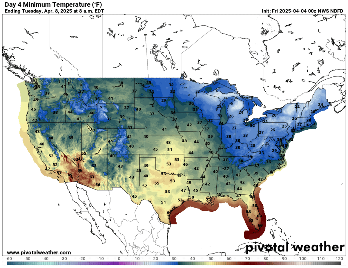
This will bring a pretty cold Tuesday morning across the Great Lakes and the Northeast U.S., with lows in the mid-20s.
Below-freezing temperatures will also spread across Washington, D.C., New York, and Boston.
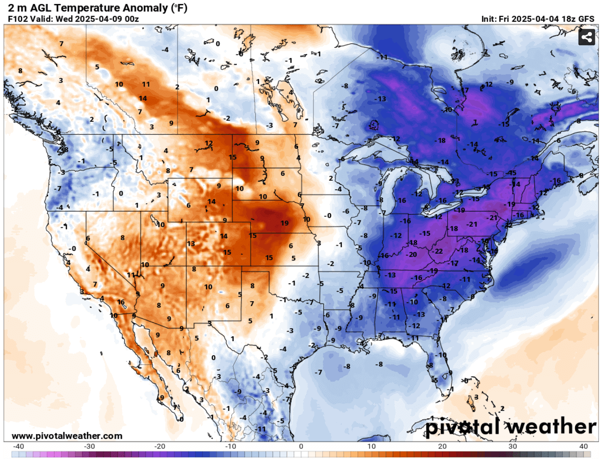
By Tuesday afternoon, the Arctic cold blast will become larger and engulf much of the eastern United States. Its core will be parked over the Ohio Valley, Great Lakes, Mid-Atlantic, and Northeast regions.
The mid-level air mass will be 12-16 °C colder than usual, which is significant for early April.
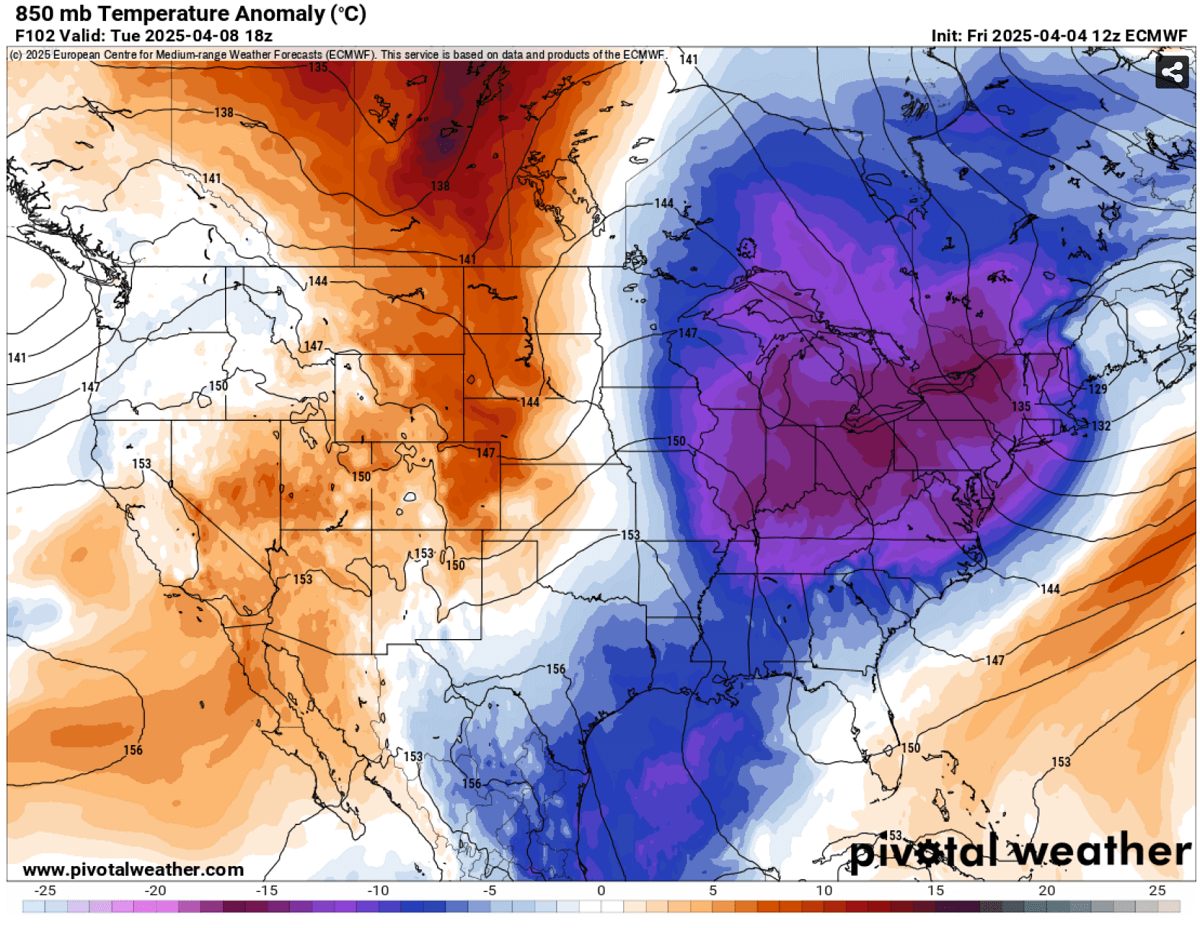
Therefore, Tuesday will be quite a cold day. Near-surface temperatures will be 15 to 25 °F colder than usual across Tennessee and the Ohio Valley, the Mid-Atlantic, and the Northeast U.S.
On Tuesday, the East Coast and the Southeast U.S., including Florida, will experience cold temperatures of 10-15 °F below normal.
While the upper wave gradually ejects off the coast into the Northwest Atlantic on Wednesday, conditions will improve from west to east during mid-week.
Wxcharts, Windy, and Pivotalweather provided images used in this article.
See also: